> ## Documentation Index
> Fetch the complete documentation index at: https://docs.nikaplanet.com/llms.txt
> Use this file to discover all available pages before exploring further.
# Data & Conversion
> Connect your files and external or satellite data sources, then inspect and convert across 100+ geospatial formats — all from chat.
## Bring Your Own Data
NIKA Desktop meets your data where it already lives. Point the agent at the files and systems your team uses every day, and it reads them in place — no migration, no reformatting, no manual tagging.
 Reports, PDFs, drawings, field photos, spreadsheets, and raw geospatial datasets — drop them in and the agent works directly with them.
Pull in the external and satellite data sources your industry already relies on to enrich the analysis with up-to-date context.
## Data Inspection
NIKA includes built-in tools for inspecting geospatial data without leaving the chat.
* **Vector metadata** — read layers, coordinate reference systems, and attribute schemas from any supported vector format
* **Raster metadata** — read dimensions, band counts, CRS, and statistics from any supported raster format
## Format Conversion (100+ Formats)
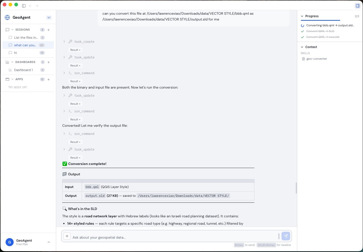
Convert between formats with a single request to the agent — no GIS desktop software required.
| Category | Formats |
| ---------------- | -------------------------------------------------------------------------- |
| **Raster** | COG, GeoTIFF, JPEG2000, ECW, MrSID, PNG, JPEG |
| **Vector** | GeoJSON, Shapefile, GeoPackage, FlatGeoBuf, GeoParquet, KML, KMZ, CSV, DXF |
| **Vector Tiles** | PMTiles, MBTiles |
| **3D** | LAS, LAZ, Cesium 3D Tiles, COPC, STL, OBJ, GLB, glTF |
| **Styles** | SLD, QGIS QML |
Conversions happen inside the [autonomous tool loop](/nika-desktop/autonomous-analysis) — so a single request like *"convert these shapefiles to GeoParquet and map the result"* is handled end to end, with the output ready to [visualize](/nika-desktop/visualizations) immediately.
Reports, PDFs, drawings, field photos, spreadsheets, and raw geospatial datasets — drop them in and the agent works directly with them.
Pull in the external and satellite data sources your industry already relies on to enrich the analysis with up-to-date context.
## Data Inspection
NIKA includes built-in tools for inspecting geospatial data without leaving the chat.
* **Vector metadata** — read layers, coordinate reference systems, and attribute schemas from any supported vector format
* **Raster metadata** — read dimensions, band counts, CRS, and statistics from any supported raster format
## Format Conversion (100+ Formats)
Convert between formats with a single request to the agent — no GIS desktop software required.
| Category | Formats |
| ---------------- | -------------------------------------------------------------------------- |
| **Raster** | COG, GeoTIFF, JPEG2000, ECW, MrSID, PNG, JPEG |
| **Vector** | GeoJSON, Shapefile, GeoPackage, FlatGeoBuf, GeoParquet, KML, KMZ, CSV, DXF |
| **Vector Tiles** | PMTiles, MBTiles |
| **3D** | LAS, LAZ, Cesium 3D Tiles, COPC, STL, OBJ, GLB, glTF |
| **Styles** | SLD, QGIS QML |
Conversions happen inside the [autonomous tool loop](/nika-desktop/autonomous-analysis) — so a single request like *"convert these shapefiles to GeoParquet and map the result"* is handled end to end, with the output ready to [visualize](/nika-desktop/visualizations) immediately.