

Overview
NikaMap is a high-performance WebGL-based large-scale map framework designed to handle massive geospatial datasets with unprecedented efficiency. Leveraging advanced GPU-accelerated rendering techniques, NikaMap delivers desktop-class GIS performance directly in the browser.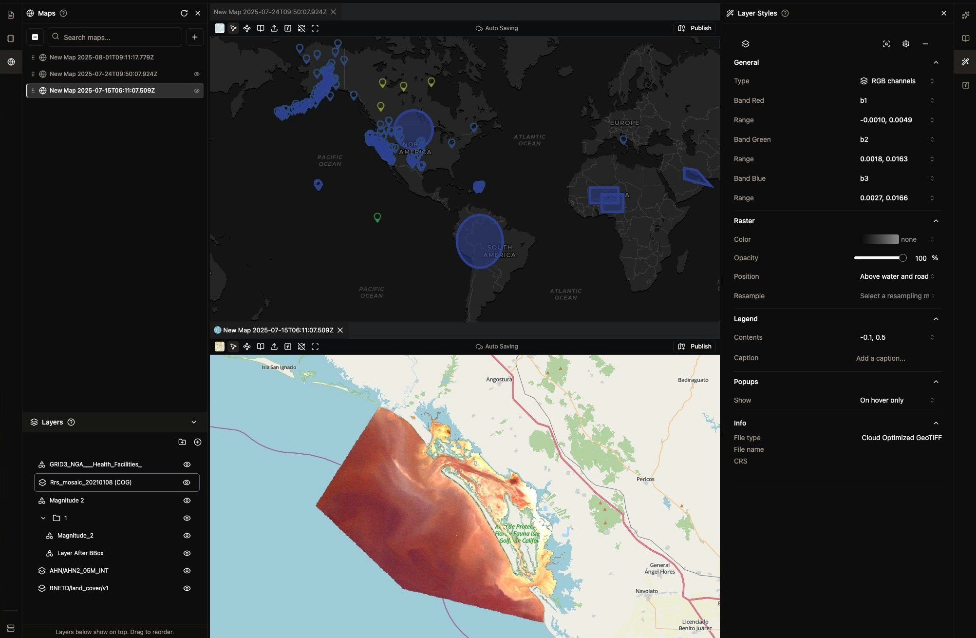
Core Capabilities
High-Performance Rendering
- Large-Scale Vector Data: Efficiently render millions of vector features with GPU-accelerated processing
- Massive Raster Support: Handle gigabytes of raster imagery with intelligent tiling and streaming
- Advanced Symbology: Rich styling capabilities including data-driven visualizations, custom color ramps, and complex symbology rules
- 3D Visualization: Native 3D rendering support for terrain, buildings, and volumetric data
- Smooth Performance: WebGL-powered rendering ensures fluid interactions even with complex datasets
Data Format Support
- Vector Formats: GeoParquet, GeoPackage, FlatGeobuf, GeoJSON, Shapefiles, KML/KMZ
- Raster Formats: GeoTIFF, Cloud Optimized GeoTIFF (COG), JPEG2000, ECW, HFA
- Drone Imagery: Native support for JPEG with EXIF metadata and aerial photography
Visualization Features
- Multiple Layer Types: Vector, raster, point cloud, and 3D layers
- Custom Styling: Advanced styling options for all data types
- Interactive Features: Popups, tooltips, and dynamic interactions
NikaMap Sync
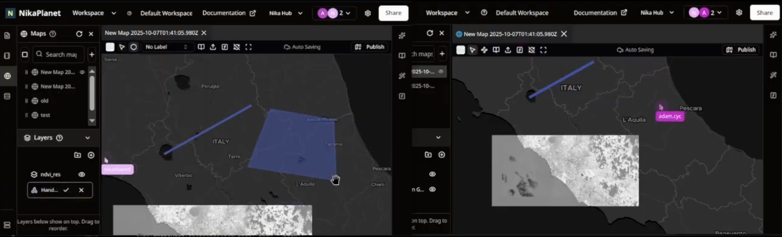
Real-Time Collaboration
- Multi-User Editing: Multiple users can edit maps simultaneously with live cursor tracking
- Auto-Save Like Google Docs: Every change is automatically saved in real-time—never lose your work
- Instant Synchronization: See changes from collaborators appear instantly on your map
- Conflict Resolution: Intelligent conflict detection and automatic resolution for concurrent edits
Cloud-Native GIS Experience
- Desktop Performance in Browser: Full-featured GIS capabilities without installing desktop software
- Seamless Data Access: Tap into large-scale datasets stored in the cloud without local downloads
- Version History: Track all changes with complete edit history and rollback capabilities
- Collaborative Permissions: Granular control over who can view, edit, or manage map layers
Enterprise Features
- Team Workspaces: Organize maps and data within shared team environments
- Change Tracking: Audit trail of all edits with user attribution and timestamps
- Branching & Merging: Create map variants and merge changes back to main version
- Real-Time Notifications: Get notified when collaborators make changes to shared maps
Getting Started
Creating Your First Map
Initialize NikaMap with your container element and configure center, zoom, and visualization options. Add various layer types including vector layers with millions of polygons, raster layers with gigabytes of data, and drone imagery with automatic georeferencing. For NikaMap Sync, simply enable thesync option to activate real-time collaboration and auto-save features.
Integration
NikaMap integrates seamlessly with other Nika products:- NikaWorkspace: Use workspace data directly in maps
- NikaStudio: Embed maps in custom applications
- NikaHub: Share and publish maps
- NikaNotebook: Analyze map data with Python notebooks
Get Expert Help
Talk to a Geospatial Expert
Need help with your geospatial projects? Our team of experts is here to assist you with implementation, best practices, and technical support.
Other ways to get help:
- Guides: Use the /guides tab for detailed tutorials
- Community: Ask questions in our community forum
- Support: Send us a support request